The sky above you this December might look ordinary—soft clouds, a pale winter sun, the same breath of cold brushing your cheeks. But high, far above where planes roam, something unusual is brewing, like a hidden storm unfolding in slow motion. The air you feel is only the surface of a much taller, stranger story: one that starts in the thin, electric-blue reaches of the stratosphere and could tilt the entire winter on its axis.
The Winter Story Written 30 Miles Above Your Head
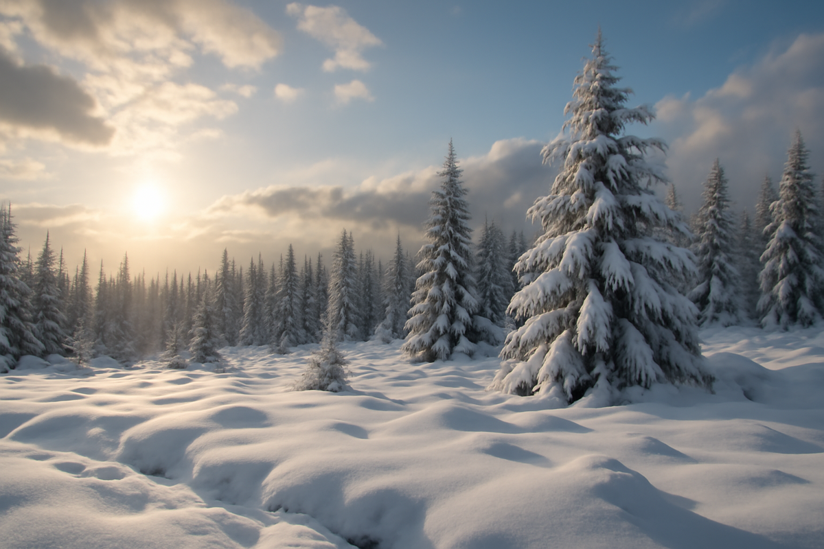
Imagine standing outside on a still December night. The world is quiet, damp with early snowmelt or edged with frost. You can see your breath in the air, a small, fleeting ghost that rises and disappears. Now, stretch your imagination upward—past the clouds, past the jet stream, up through the troposphere where our weather is born, and into the colder, rarified band of atmosphere called the stratosphere.
Up there, roughly 10 to 50 kilometers above your head, the air is thin and strange. Temperatures rise with height instead of falling. The ozone layer drinks in ultraviolet light. And swirling around the pole in winter is a colossal river of wind: the polar vortex. Most winters, this vortex is like a spinning top—cold, fast, and mostly stable—keeping the deepest Arctic chill locked up near the North Pole.
This year, though, that spinning top is wobbling early. Lurking in the December darkness is a rare, early-season stratospheric warming event—an atmospheric plot twist that may rewrite the winter forecast from Alaska to Europe, from the American Midwest to East Asia.
The Rare Heat Wave No One Feels—But Everyone Lives With
What Is Stratospheric Warming, Really?
Stratospheric warming sounds simple: the upper atmosphere warms. But the way it happens is anything but simple. In early winter, massive waves of energy—formed by mountains, land–sea contrasts, and storm patterns—ripple upward from the troposphere into the stratosphere. When these waves are strong enough, they crash into the polar vortex like unseen surf, slowing it down, warping it, sometimes even tearing it apart.
When this happens dramatically, meteorologists call it a “sudden stratospheric warming” (SSW). Temperatures in the polar stratosphere can rocket up by 30 to 50°C (over 50°F) in just a few days—an astonishing shift for such a lofty realm. The air overhead changes from brutally cold to relatively mild, even as the ground below may still feel wintry.
But this year’s potential warming is especially striking because of its timing. The atmosphere seems to be gearing up for a significant disturbance in December—earlier than usual, and in a season already shaped by El Niño, warm oceans, and shifting climate baselines. In atmospheric terms, that’s like moving an important scene earlier in the movie; it changes everything that follows.
Why December Matters So Much
Most notable stratospheric warmings tend to happen in January or February. By then, the polar vortex has had time to spin up, the darkness of polar night is at its deepest, and the system is primed for disruption. December events are rarer—and, in many ways, more influential on the winter as a whole.
A December SSW or strong stratospheric disturbance can send its impacts cascading down into the lower atmosphere right when the season is still young. Instead of simply bending the winter’s closing chapters, it can reshape the entire narrative: who gets snow, who shivers under Arctic blasts, and who ends up wondering why winter feels oddly tame.
To understand just how unusual this is, it helps to see how often these events occur and how early they tend to arise.
| Feature | Typical Pattern | What We’re Seeing This Year |
|---|---|---|
| Timing of major warming | Mostly January–February | Developing in December, earlier than normal |
| Polar vortex strength | Strong and fairly stable early in winter | Already disturbed and weakening |
| Forecast confidence | Seasonal outlooks somewhat steady | Winter forecasts being actively re-evaluated |
| Downstream weather risk | Cold snaps later, shorter-lived | Higher chance of earlier, prolonged cold outbreaks |
How a Wobbling Vortex Rewrites Weather on the Ground
From Blue Maps to Red Cheeks
Weather models sometimes make this process look too sterile: neat rings of wind speeds, clean temperature gradients, elegant contour lines swirling around the pole. In reality, the influence of stratospheric warming is something you feel in your bones.
When the polar vortex is strong and tightly wound, cold air tends to stay bottled up in higher latitudes. Winters in mid-latitude cities become milder, wetter, and more predictable. But when stratospheric warming disrupts that vortex—stretching it, weakening it, or splitting it into lobes—cold Arctic air can spill southward in unpredictable surges.
Maybe that looks like a frigid outbreak over North America, with icy winds rattling old window frames across the Midwest and Northeast. Maybe it’s a persistent cold lock over Europe, where cobblestone streets crunch under repeated snowfalls. Or maybe East Asia takes the brunt: bitter winds strafing the Korean Peninsula, deep cold grinding across northern China or Japan.
Stratospheric warming doesn’t guarantee such cold spells; it simply opens the door. It flips the odds. A December event flips them sooner, while there’s still a long stretch of winter left to work with.
The Downward Drift: How the Signal Travels
The real magic—and mystery—lies in how a warming 30 or 40 kilometers up can alter the wind patterns near the ground. Think of the atmosphere as a stack of invisible rivers, each layer nudging the one below. When the polar vortex is disrupted, the pattern of high and low pressure systems above the mid-latitudes changes. These shifts then propagate downward like a slow echo.
Over several days to a few weeks, this echo reaches the troposphere, where the weather we feel is made. The jet stream—the high-altitude current steering storms—can buckle, stall, or reroute. High-pressure domes may build where low pressure is usually expected, and vice versa.
On a weather map, this looks like a reorganization of the familiar patterns: blocking highs forming over Greenland or Scandinavia, storm tracks dipping further south, or cold pools lingering where they normally pass through quickly. On the ground, it leads to those memorable runs of weather people talk about years later: the week the river froze early, the storm that buried a town in snow, the cold snap that wouldn’t quit.
Why This December Is Making Forecasters Nervous (and Excited)
A Winter That Refuses to Sit Still
Long-range forecasts for this winter were already complicated. An El Niño pattern in the Pacific is tending to shift the jet stream southward and load the southern tiers of North America with moisture. Oceans are running unusually warm in many regions, pumping extra heat and energy into the atmosphere. Arctic sea ice, still below historical norms, is changing how cold air gathers and moves.
Add a rare early-season stratospheric warming on top of that stack, and the scene becomes much more dynamic—and less certain.
Seasonal outlooks, built on average probabilities, often suggest gently tilted odds: “slightly milder,” “somewhat wetter,” “above-average snowfall possible.” But the stratosphere does not care for gentle tilts. A major disturbance can tip the table, leaving forecasters scrambling to adjust their narratives.
Instead of one smooth winter arc, we may get a winter that swings between contrasts: sudden thaws followed by brutal freezes, dry spells giving way to surprising snowstorms, and a sense that the season refuses to settle into a single personality.
Who Might Feel It Most?
Forecasters are paying close attention to regions where the effects of a weakened polar vortex often show up most dramatically:
- North America: The central and eastern United States, as well as parts of Canada, often face increased risk of Arctic outbreaks after major stratospheric warmings. An early event could mean earlier or more frequent cold shots, layered atop an El Niño–driven storm track bringing moisture to the South and East.
- Europe: Northern and western Europe often experience blocked patterns and cold spells in the wake of SSWs, with potential for extended snow cover and persistent chill, especially when high pressure sets up over Greenland or Scandinavia.
- East Asia: Japan, Korea, and northern China are no strangers to polar-vortex-driven cold surges. A disrupted vortex can channel bitter air masses south, delivering sharp, memorable cold waves.
But it’s not just about cold. In some places, the same atmospheric reshuffling can lead to milder, stormier, or oddly dry conditions. When the jet stream shifts, someone’s snowstorm becomes someone else’s rain; someone’s deep freeze becomes someone else’s eerily warm midwinter day.
Living With a Winter That’s Being Rewritten in Real Time
How This Shapes Daily Life
You may never see the polar vortex, never feel the stratospheric warming directly, but the effects touch quiet corners of daily life.
A farmer planning winter feed and late-winter calving watches the evolving forecast and wonders if the cold will bite deeper or last longer than expected. A city snowplow department reviews its salt and fuel budgets, suddenly less confident in the old averages. A commuter dusts off snow boots earlier, eyeing the sky in the morning with new suspicion.
Energy demand can spike during extended cold events, stressing power grids and raising heating costs for millions of households. Transportation networks negotiate icy runways, snow-choked roads, and rail systems that strain under sudden surges of cold. Emergency services quietly prepare for more slips, falls, and weather-related accidents.
At the same time, some ecosystems seize the moment. Trees that require a certain amount of winter chill may welcome longer, colder stretches, even as early-season warmth and sudden thaws can confuse budding cycles. Wildlife adjusts routes and habits: birds lingering in places that stay warmer, predators following the snow line, insects burrowing deeper or, in odd thaws, waking too soon.
Forecasts as Living Documents
To the meteorologists tracking this, winter becomes less a static forecast and more a living document—one that has to be revised as the stratosphere reveals its hand. They watch ensemble models that simulate dozens of parallel futures. They look for the “downward coupling,” the telltale signs that the stratospheric disruption is making its way into the troposphere.
In offices glowing with monitor light, they compare these evolving patterns against decades of historical analogs: past winters with early SSWs, winters with El Niño plus vortex disruptions, winters where the jet stream curled just so across the continents. But the atmosphere never repeats itself exactly. It only rhymes.
So, forecasts become stories in progress. A December outlook that once leaned confidently milder for a region may need a quiet, careful footnote: “Increased risk of colder conditions later in winter if current stratospheric signals continue.”
What This Means for You, Here and Now
Watching the Sky With New Eyes
You don’t need to memorize acronyms or parse model charts to live with this knowledge. But it can change the way you experience the season unfolding outside your window.
When the first deep cold snap arrives earlier than usual, you might think of invisible waves breaking far above, weeks earlier—of the high atmosphere falling out of its usual script. When a snowstorm tracks unusually far south or lingers instead of racing past, you might recall the buckled jet stream, slow-dancing under the influence of a faltering polar vortex.
This awareness can also inspire practical choices:
- Be flexible with winter plans. From travel to outdoor work, allow for swings—not just in one direction, but from mild to harsh and back again.
- Pay attention to updated forecasts. Seasonal outlooks are not carved in stone. In winters like this one, medium-range and week-ahead guidance can shift significantly as the atmosphere responds.
- Prepare for extremes, not just averages. A winter affected by stratospheric disruption is more likely to produce memorable events—cold waves, heavy snows, or sharp thaws—than a smooth, forgettable season.
There’s a kind of quiet awe in realizing that the shape of your winter coat’s usefulness, the thickness of the ice on a local pond, even the taste of the air on your morning walk might be linked to atmospheric jolts 30 miles overhead.
Questions People Are Asking About This Winter’s Stratospheric Warming
Is an early stratospheric warming the same as a “polar vortex collapse”?
Not always, but they are closely related. A sudden stratospheric warming often weakens the polar vortex significantly, and in some cases can split or fully disrupt it. When people talk about the “polar vortex collapse,” they are usually describing the tropospheric consequences of a major stratospheric disturbance—when the disruption aloft has worked its way down and reshaped surface weather patterns.
Does a December warming guarantee a colder winter where I live?
No, it changes the odds but does not promise a specific outcome for any one location. A strong early-season disturbance tends to increase the chance of colder, more blocked patterns later in winter across parts of North America, Europe, and Asia. However, local conditions depend on how the jet stream rearranges itself, which regions end up under high or low pressure, and how other climate drivers like El Niño interact with the pattern.
How long after a stratospheric warming do we see impacts on the ground?
Typically, the influence reaches the lower atmosphere within about one to three weeks, though the exact timing varies. In some cases the signal is weak or gets muddled by other weather drivers; in others, it translates into clear, prolonged shifts in temperature and storm tracks that can last several weeks.
Will this make extreme cold events more common in a warming climate?
The broader climate is warming, and average winters are trending milder in many regions. However, stratospheric disruptions can still produce intense cold spells on top of that warming background. There is ongoing scientific debate about whether a changing Arctic and warming climate are altering the frequency or character of these events, but for now, they remain capable of sharp, memorable cold waves even in a warmer world.
What should I watch for in forecasts if I’m concerned about this?
Look for mentions of “polar vortex weakening,” “sudden stratospheric warming,” or “negative Arctic Oscillation” in seasonal and medium-range outlooks. Pay particular attention to updated 10–30 day forecasts, which may shift as the stratospheric signal couples downward. For practical planning—travel, heating, outdoor work—check local forecasts frequently, especially when forecasters highlight pattern changes or blocking highs developing over the Arctic and North Atlantic.
Somewhere above the winter clouds, that story is still being written—winds faltering, temperatures lurching upward in the thin air, the polar vortex rethinking its grip on the season. Down here, we stand under an ordinary-looking sky, unaware that the script for the rest of our winter—our commutes, our snow days, our power bills, our walks in breath-frosted air—is quietly being revised far, far above our heads.

Hello, I’m Mathew, and I write articles about useful Home Tricks: simple solutions, saving time and useful for every day.